
Fort Dodge, Iowa Weather and Webcams
Radar – State of Iowa
 Webcam – Humboldt, Iowa
 Webcam – ISU/Ames, Iowa
Storms return to the forecast on Thursday.
AM storms could have an isolated hail threat, but additional development later Thurs into Thurs night has a level 2 (of 5) risk for severe weather with large hail the primary risk.
Have plans? Keep up to date with the latest forecast.


🔥Elevated fire danger this afternoon into early evening with breezy winds out of the northwest, dry surface vegetation, and low relative humidity values.
Burning is discouraged!
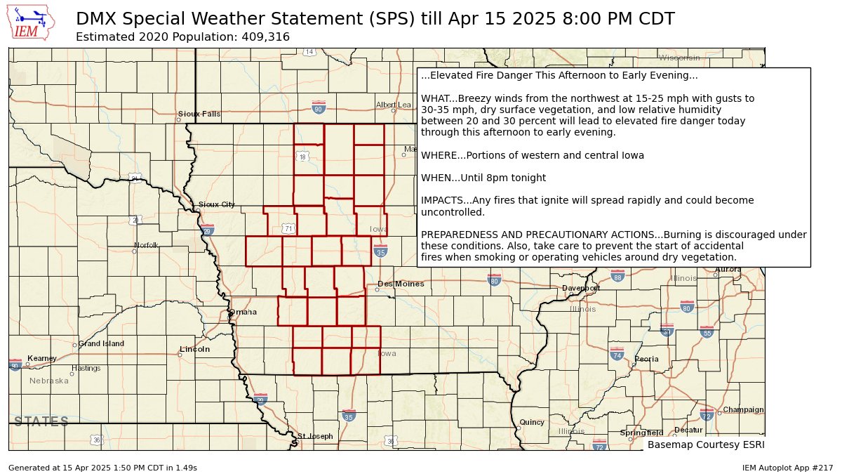
Elevated Fire Danger This Afternoon to Early Evening for Adair, Adams, Audubon, Boone, Calhoun, Carroll, Cass, Clarke, Crawford, Dallas, Decatur, Emmet, Greene, Guthrie, Hamilton, Hancock, Humboldt, Kossuth, Madison, Palo Alto, Pocah... till 8:00 PM CDT https://mesonet.agron.iastate.edu/p.php?pid=202504151850-KDMX-WWUS83-SPSDMX
While temperatures remain on the cooler side today, dry and breezy conditions will make fires easy to ignite and spread. Burning is highly discouraged today! #iawx

🌬️7pm - Scattered showers, and possibly a brief thunderstorm or two, will continue to move across central IA this evening. NW winds gusting 30-40 mph will persist, and a few gusts to around 55 mph may occur near precipitation. Winds should diminish by 9pm. #iawx
Scattered showers and thunderstorms will spread southeastward across much of Iowa this afternoon and evening. While it is already windy this afternoon, stronger and gustier winds over 45 mph may accompany these showers and storms as they pass over a location. #iawx

Strong winds from the northwest at 20 to around 30 mph with gusts over 35 mph along with mainly dry grasses and vegetation and low relative humidity between 30 and 40 percent will lead to elevated fire danger today. Burning is discouraged under these conditions. #iawx
